2023 will likely be one of the hottest years on record after our extreme summer, including record-setting temperatures in June and July (Scientific American). As we enjoy the fall weather and find reprieve from prior scorching highs, it’s an important time to reflect on the leading weather-related killer in the U.S.: heat (EPA). But the burden of heat—and the associated health impacts and high costs of air conditioning—is not equally felt. Heat exposure is determined by where we work and live. As a group, Latinos face outsized heat risk, both because of broader employment patterns and because they are more likely to live in urban heat islands. Heat thus poses an outsized threat to the wellness and financial stability of Latino families all over the country (Union of Concerned Scientists). We, the authors, are committed to working, learning, and living environments in which Latinos feel included, welcomed, and safe from high temperatures. Read on to find out how you can help make that a reality!
We (the authors) are two mixed race Latinas living in Washington County, Oregon, part of the larger Portland metro area. Like many other Pacific Northwest residents, we were forced by the 2021 “heat dome” to recognize and confront the realities of a hotter climate (National Academies). In order to respond properly to the increasing heat risk, we need to collect data, adapt to the changing circumstances, and create equitable solutions that account for the additional heat burden borne by Latinos in our rapidly changing climate.
Heat poses a higher risk to Latinos as a group for a couple of reasons. For one, many Latinos work jobs which keep them outdoors, even during hot temperatures. Latinos are disproportionately represented in the agricultural, construction, and utility workforces (McKinsey & Company). For people who work outdoors, the increasingly severe and frequent heat waves in the U.S. not only pose increased physical risks but also financial risks because they reduce the number of safe workdays per year.
For another, racial minorities are more likely than white community members to live in urban areas. Latinos, in particular, are a highly urbanized population (Pew Research Center) and are more likely to live in low-income and inner-city neighborhoods with less vegetation and green space (Hispanic Action Fund). As thoughtfully covered by a prior GreenLatinos blogpost, these urbanized areas experience higher temperatures than their suburban and rural surroundings, in part because pavement, brick, and steel absorb, retain, and re-radiate heat (NASA). Dense urban areas can experience afternoon temperatures that are as much as 20°F warmer than their suburban or rural surroundings (NIHHIS). These high temperatures in urban heat islands are dangerous, threatening human health, contributing to energy poverty, and even undermining academic success (The Hill; Scientific American).
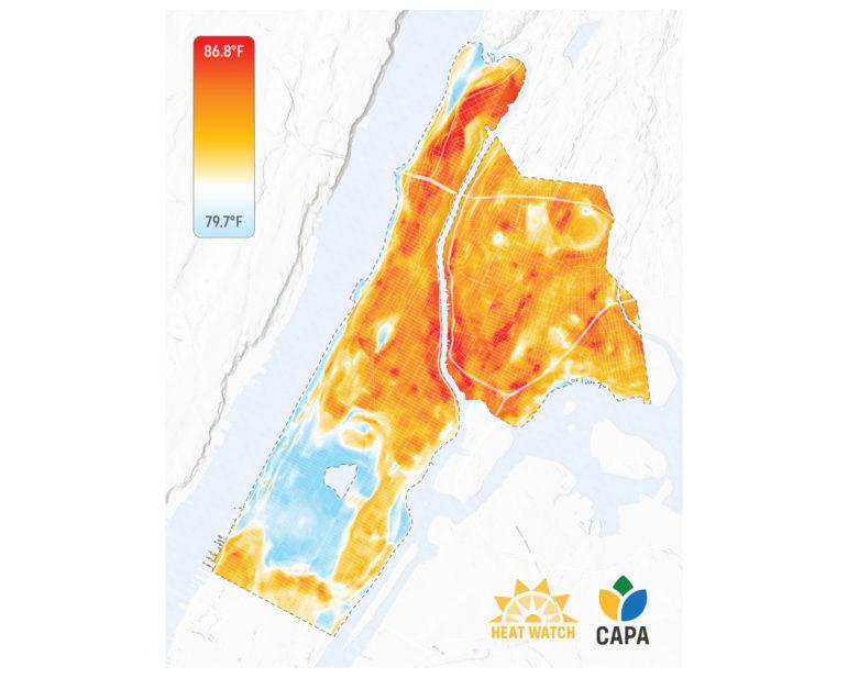
We still have a lot to learn about exactly how severe the air temperature differential is in urban heat islands. Luckily, this summer, the National Oceanic and Atmospheric Administration and CAPA Strategies invited local residents in over a dozen U.S. cities/counties (and Santiago, Chile) to map the hottest parts of their communities (NOAA). These resident “street scientists” traveled through their neighborhoods on one of the hottest days of the year with a heat sensor mounted on their car. The sensors recorded temperature, humidity, location, and time every second in order to understand how the human-built environment alters local temperatures. This data is then transformed into a high-resolution map that identifies the hottest and coolest places across neighborhoods (New York City example below). These “heat maps” of U.S. communities will be released throughout the next few months, which is where GreenLatinos’ members and allies come in.
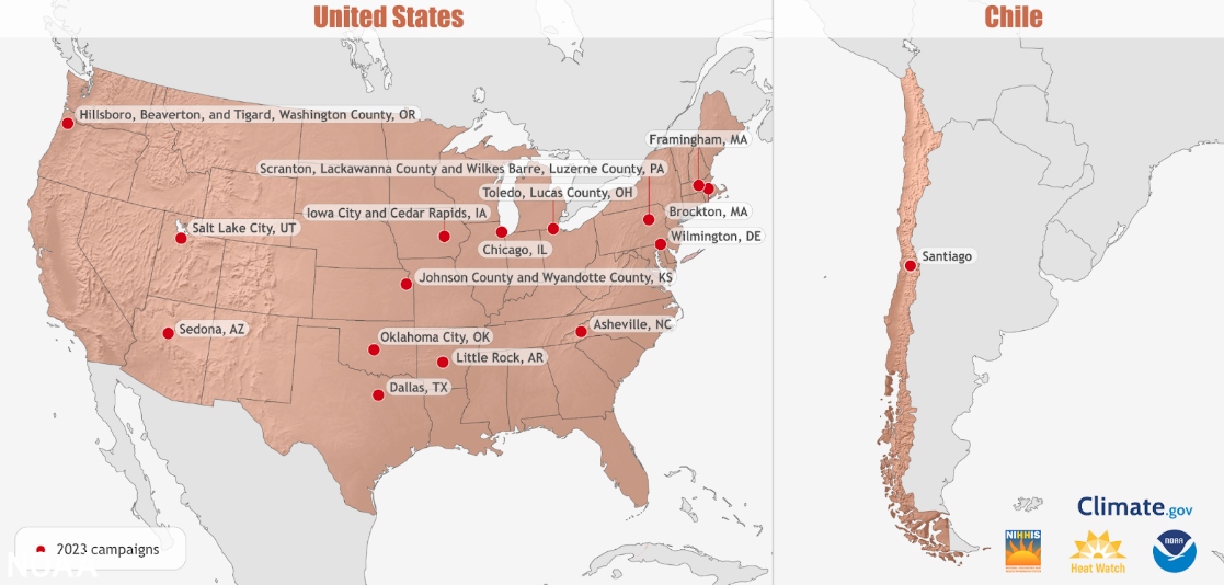
[Image 1. Caption: NOAA worked with resident “street scientists” to map urban heat islands in multiple cities and counties in 14 states this summer and in one international city, Santiago, Chile. Image credit: NOAA]
The heat maps can and should inform hyper-local strategies to keep people safe. With Latino populations bearing an unequal exposure burden as the planet heats up due to climate change, solutions must be focused on protecting those most impacted. Here we offer a few examples. The maps can be used to identify the best location for a new public transit shelter or to prompt the residents of the hottest neighborhoods to check in on the most vulnerable. Find your local report and confirm your policy leaders have a copy; share the tool and insist that they use it. Urge your city councilors to apply the data to local zoning and investments decisions. Advise your state representative to use the tool to inform bills and funding priorities. Advocate for your park leaders to use the maps to increase shade canopy in the hottest neighborhoods.
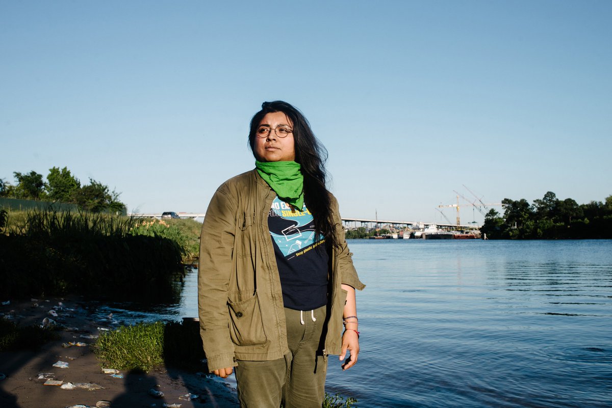
[Image 2. Caption: New York City-based researchers and volunteers collected data to document neighborhood temperatures. Image Credit: CAPA Strategies.]
This work on heat dangers is important to the Latinidad community as a whole, and is especially so to the authors. Dr. Adelle Monteblanco is an Assistant Professor of Public Health at Pacific University (Forest Grove, Oregon) who focuses her research on vulnerable populations like pregnant people who may struggle to regulate their body temperature over prolonged heat exposure. Her work is increasingly relevant in a changing climate, for pregnant Latinas are already at greater risk for gestational diabetes and pregnancy-related blood pressure disorders (Salud); a hotter climate and more heat risk will create more consequences for Latinas’ maternal health. Felicita Monteblanco, Board Director at Tualatin Hills Park and Recreation (THPRD) (Beaverton, OR), celebrates the ways urban parks cool the air and mitigate the impact of the urban heat island effect; she and the THPRD team are eager to use the heat mapping data collected to shape their decision making, including the location of future parks.
We are invested in the long-term sustainability of our region and the health of its residents, just as you are invested in yours. Latines are a crucial part of the social, political, and economic fabric of our country, yet they carry a disproportionate heat burden. If your community is one of the many that were heat mapped this summer (Image 1), we hope you’ll engage by strategizing local solutions to reduce heat exposure and holding leaders accountable to equitable interventions. Latinx communities would benefit greatly from additional resources, including the creation of more shade from city planning projects, additional cooling centers, and active participation in government decision-making.
Author Bio
Dr. Adelle Monteblanco is an Assistant Professor of Public Health at Pacific University (Forest Grove, OR) where she teaches courses on environmental health and the built environment. Felicita Monteblanco is the Public Affairs Manager at Northwest Health Foundation (Portland, OR) and serves on the Board of Directors for Tualatin Hills Park and Recreation District (Beaverton, OR).
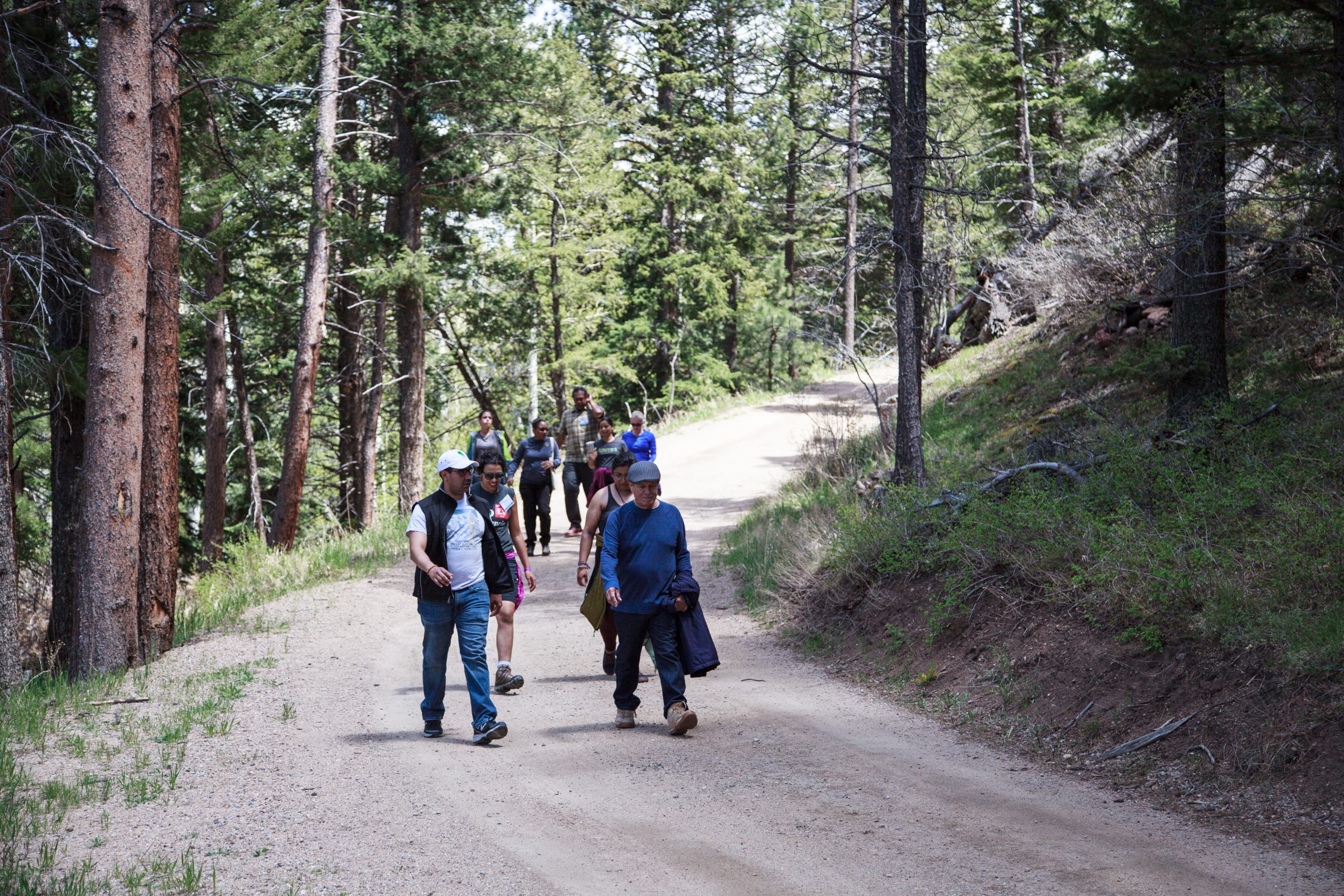
Image 3. Caption: Felicita and Adelle at a THPRD park. February 2023. Image credit: Felicita Monteblanco